Microclimate Analysis Attisholz, Switzerland
Microclimate Simulation in Real Estate Development

Our client Halter AG, active in the real estate market since more than 100 years, is one of Switzerlands leading construction companies, real estate service provider and developer. As a very climate-conscious developer with a view on urban density as chance to create a built environment with high quality of life while developing as climate-conscious as possible, Halter AG emphasizes consolidation and renovation as social, economical and political opportunity to create high-quality living space for people. At the same time Halter AG fully embraces the digitalization of architecture that allows a much better synthesis of urban planning and architecture and fast and efficient decision processes throughout the development of a project.
Together with the planning specialists of Freimüller Söllinger Architects & DnD Landscape Architects, Halter AG develops the Attisholz complex, a former cellulose industrial site, that is blooming into a vibrant area with restaurants and event spaces, art installations and playgrounds. For the continuing development into a place that will provide intermeshed living, working and community space, Rheologic was invited as environmental & wind consultant to support the planning process with wind comfort / safety and microclimate simulations to achieve the best possible sojourn quality for visitors and residents.


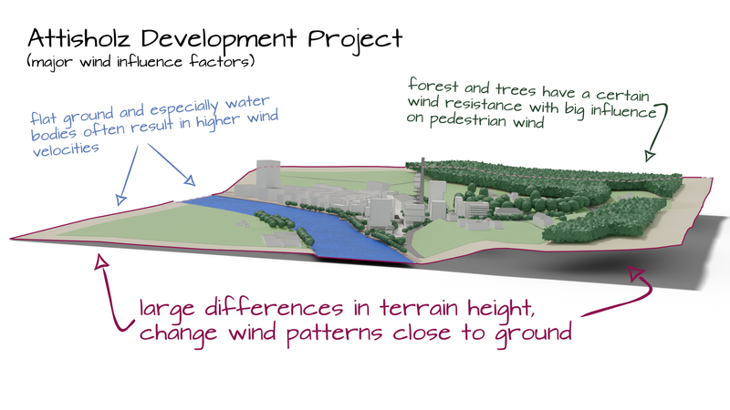
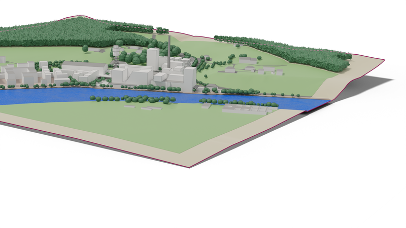
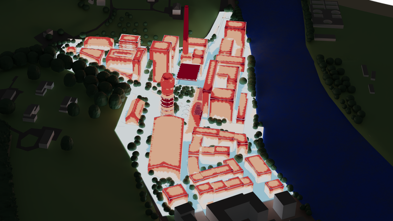
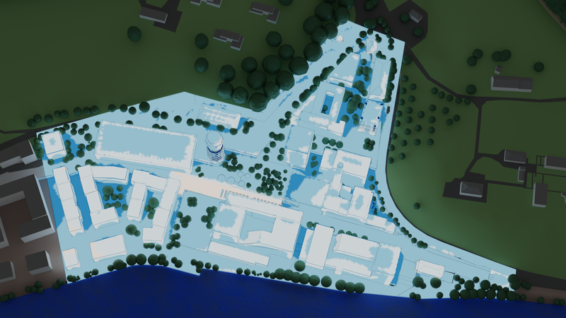
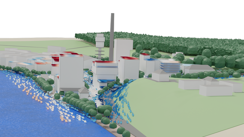
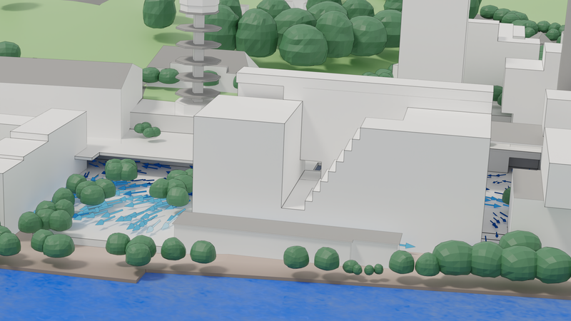
The area near the city of Solothurn in Switzerland is situated directly on the banks of the Aare river. On the other sides the buildings are mostly surrounded by more or less steep banks and hills with plenty of big, old trees and forests. Due to the complex terrain and the industrial past of the area, a simulation needs not only to accommodate the surrounding terrain to calculate accurate wind flow, but also various intertwined levels and small-resolution features in the built part, down to awnings, sun roofs and various wall openings. As important as air flow is to the micro climate, a big portion of how a place feels also depends on trees and especially also water bodies, that not only influence air temperature but also humidity, all of which was modeled to ensure optimal quality-of-living in the area.


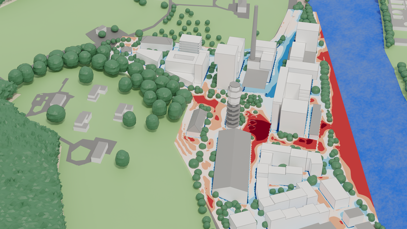
Special consideration was given to design areas for their designated use with shade and green infrastructure, especially in the light of the number of visitors attending arts events in the event location parts of the area, so that optimal micro-climatic conditions can be experienced at all times during day and night.
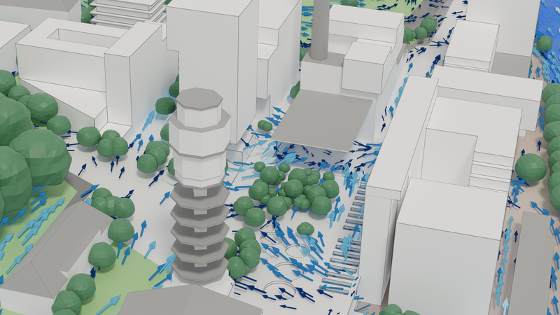
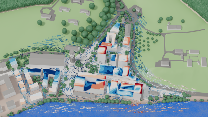
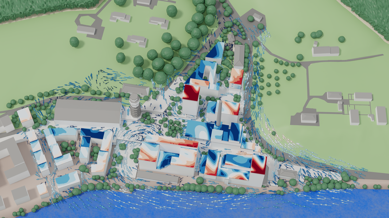
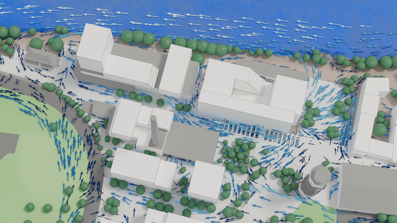
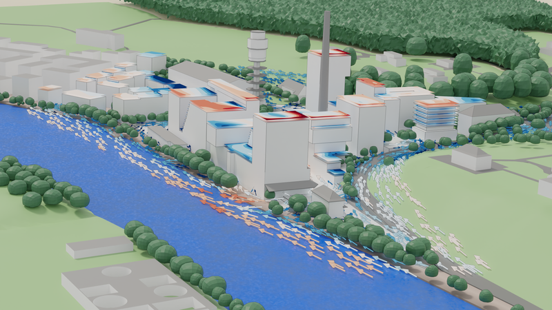
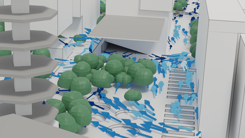
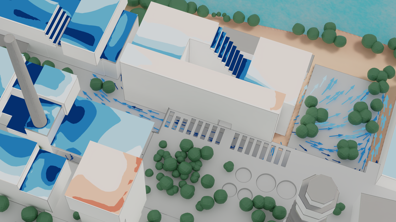
The following graphs demonstrates the importance of calculating all wind directions - in this example we see a dramatically different picture of wind direction and velocity in certain roof areas and public places even though the overall, meteorological wind direction only differs by 45°. The complex geometry of the built environment breaks the wind flow over sharp edges along planes, were a small initial difference can completely alter the wind at pedestrian level.

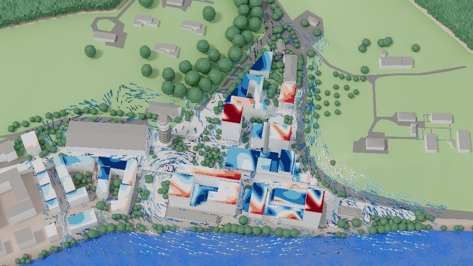
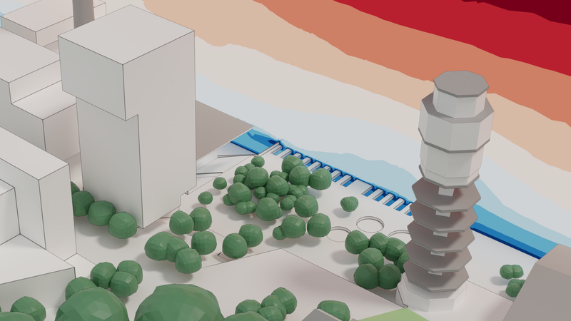
Accurate building geometries and high-resolution simulations especially near walls, awnings, sun roofs and small openings are required to plan public places for optimal safety and efficiency for their intended use-scenario. The following images show how we resolve flow near surfaces down to resolutions of centimeters.


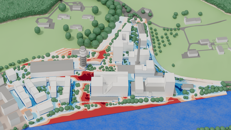
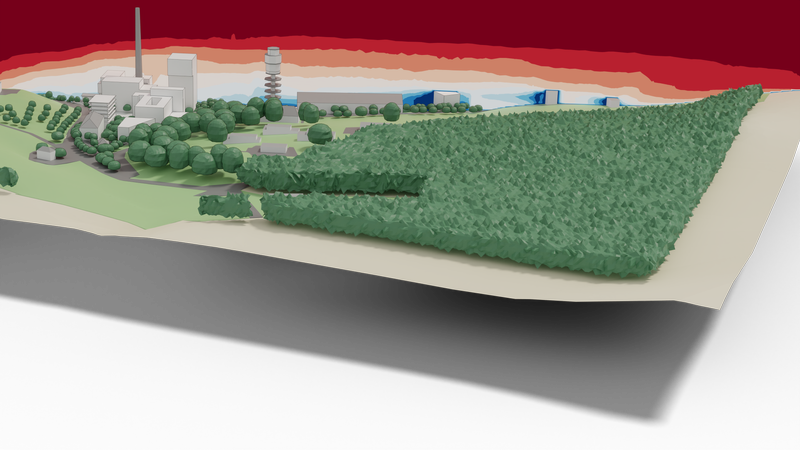
With a resolution of smaller than a meter, we are able to calculate an area of 2km² and a simulation domain height of 300m (to capture rooftop winds accurately) with a temperature standard deviation of +/- 1°C! In real-time!
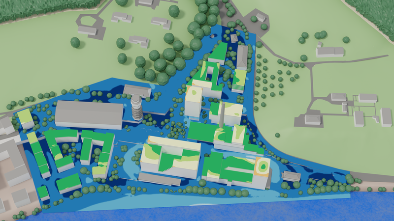
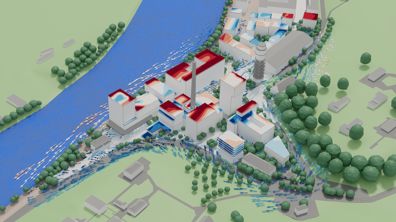
Our simulation of the Attisholz project showed great results for the microclimate performance with some areas on roof that will require adjustments and some areas that will most like be fitted with temporary shading to further improve the sojourn quality. Please see the gallery below for additional images of felt temperature, wind comfort and more and take some time to explore the online browser model for this simulation.
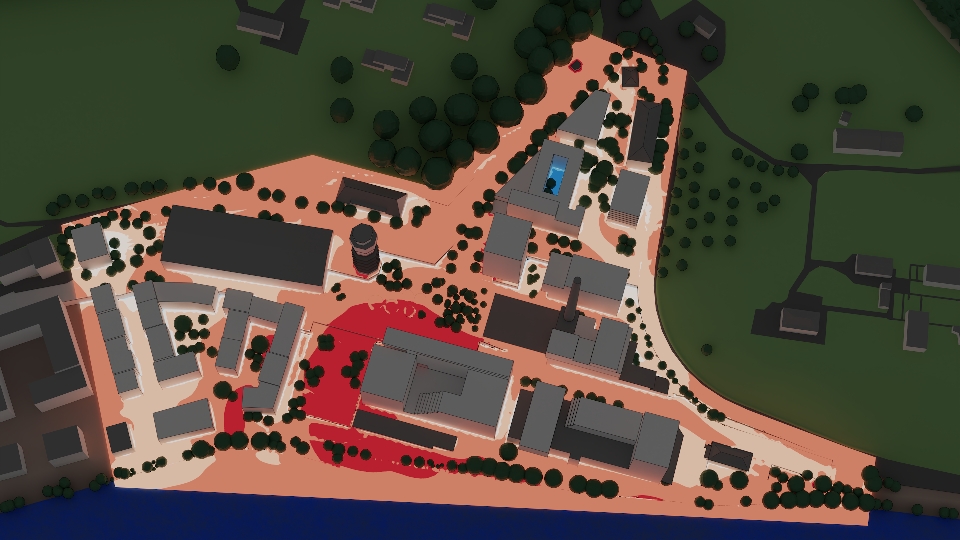
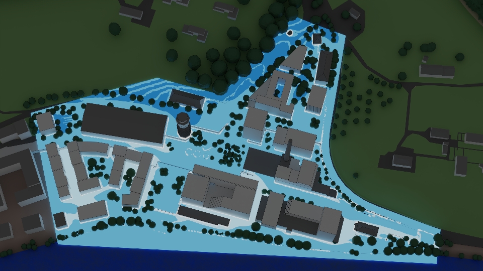
The rendered images on this page are color-coded with the actual simulation results. For a closer look at the scales, please try our interactive online model, which contains all color legends. Please note, that in some cases, the same value uses different scales, to differentiate effects better (e.g. night time air temperatures).
You can find the interactive 3D model and legends here: Interactive Microclimate Model Attisholz
In general, all horizontal, colored planes follow the underlying terrain (respectively surface) at a height of 1.5 meters. This is also valid for 3D wind vectors at pedestrian level.
Published: