Paragliding and Real Estate Development
Real Estate Development and Paragliding
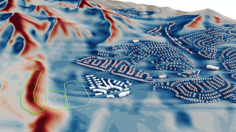
In our line of work, we frequently deal with interactions between wind, the built environment and all the things in between: from shopkeepers that want their awnings to stay were they are supposed to, to cyclists that have a hard time driving through gusty wind, to freezing pedestrians in train stations. It was a first for us, however, to look into the interactions between a real estate project developed by Wood Partners and pilot safety around the flight park of the Utah Hang Gliding and Paragliding Association (UHGPGA).

UHGPGA was concerned that the real estate development project would adversely affect wind conditions, especially at their main landing site, right next to the development area. Wood Partners, on the other hand, went out of their way to ensure that their project would integrate well into the community, and not only respect the history of the area as a flight park, but actively allow pilots to keep enjoying their hobby safely by making appropriate design choices for the building. The influence of landscape architecture on wind / turbulence is the critical design parameter here - just the job for Rheologic!
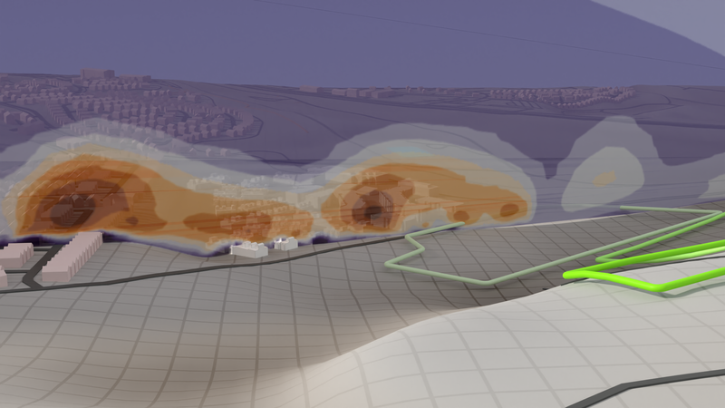
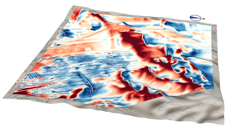
![Turbulent kinetic wind energy [m²/s²] around buildings 6ft above ground.](/generated/assets/articles/real-estate-paragliding/k_6ft-1900-2abded320.webp)
Some members of UHGPGA with engineering backgrounds provided excellent on-site wind information, including long-term wind measurements directly from the flight park, which allowed us to tune our simulation to the exact wind conditions in the area (velocity, direction, gusts, surface roughness, …) for a high-fidelity representation of the wind situation.
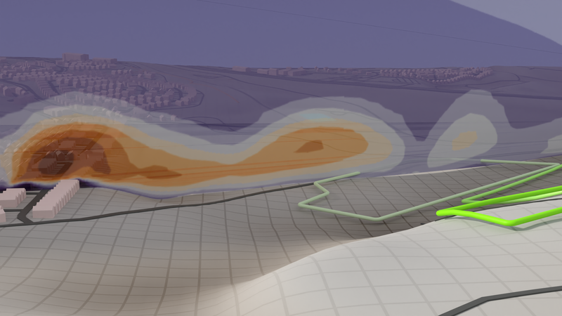
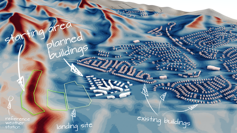
![Annotated illustration of turbulent kinetic wind energy [m²/s²] in the wake of a building in a paragliding landing area.](/generated/assets/articles/real-estate-paragliding/turbulence_hill_bldg_annotated-1900-ba36badad.webp)
The detailed wind and turbulence assessment for various wind directions, building configurations, etc. - all of which are also available in an interactive 3D model in the browser (performant hardware needed, please allow some loading time) - formed a basis for the stakeholders to discuss the best options in this participative planning process.


We are glad that our work could contribute to this participative urban planning process, and would like to express our thanks to everyone involved for the engaging discussions, improvement proposals and all their energy and time that went into this!
Published:
![Turbulent kinetic wind energy [m²/s²] around buildings 6ft above ground.](/generated/assets/articles/real-estate-paragliding/k_6ft-800-f265c748b.png)
![Annotated illustration of turbulent kinetic wind energy [m²/s²] in the wake of a building in a paragliding landing area.](/generated/assets/articles/real-estate-paragliding/turbulence_hill_bldg_annotated-800-61c5b41fc.png)
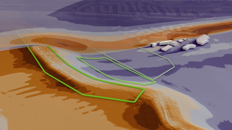
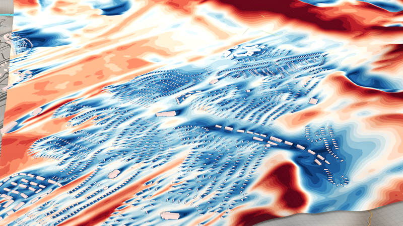
![Turbulent kinetic wind energy [m²/s²] in the wake of a building in a paragliding landing area.](/generated/assets/articles/real-estate-paragliding/turbulence_hill_bldg-800-d12e78315.png)
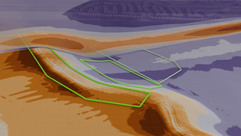
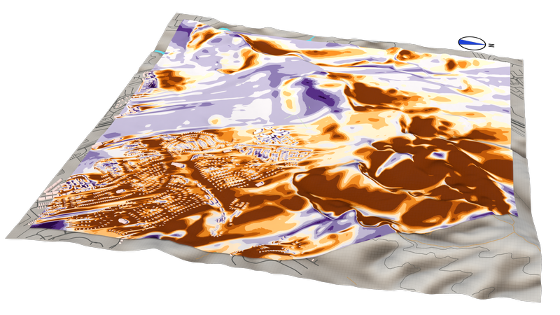
![Turbulent kinetic wind energy [m²/s²] without buildings in a paragliding landing area.](/generated/assets/articles/real-estate-paragliding/turbulence_hill-800-21ec5ed85.png)